
BIODIVERSITY NET GAIN | BASELINE HABITAT SURVEY
Biodiversity Net Gain Survey for Planning
Establish the habitat baseline needed for Biodiversity Net Gain planning and metric work.
A Biodiversity Net Gain survey records the habitats present on a development site before the project team assesses the proposals through the Statutory Biodiversity Metric. Field evidence can include habitat mapping, parcel measurements and condition information where the metric requires it.
ACP Consultants can scope and undertake BNG habitat surveys for planning projects across England. Specifically, this service focuses on the pre-development habitat baseline. The evidence can then inform metric calculations and the wider BNG assessment.
If you need the full assessment, ACP also supports the BNG assessment and UKHab baseline process.
Request a BNG Survey ScopeWhat is a Biodiversity Net Gain survey?
A Biodiversity Net Gain survey is a habitat-focused ecological survey used to establish the site's pre-development biodiversity baseline.
Fieldwork identifies and maps habitats, records their extent and gathers condition evidence where the metric requires it. However, the exact method depends on the habitats, site context and metric route.
Habitat identification and mapping
The ecologist records habitat types and boundaries to divide the site into appropriate parcels and linear features.
Habitat extent
The ecologist also measures area habitats and relevant linear features for the subsequent biodiversity calculation.
Condition evidence
Where required, the survey records evidence against the relevant statutory metric condition criteria.
Constraints requiring specialist input
The survey can also identify features needing a specialist route, such as certain watercourses or ditches.
Key point: The survey establishes habitat evidence; the metric calculation and wider BNG assessment are separate stages.
BNG survey, assessment, metric and report: what is the difference?
Several BNG terms describe connected stages, but they do not mean the same thing. Therefore, keeping them separate helps project teams commission the right work and avoids duplicating technical information.
BNG habitat survey
Main purpose
Identifies, maps and records baseline habitat extent and relevant condition evidence.
How it connects
Supplies the baseline for calculation and design.
BNG assessment
Main purpose
Integrates baseline evidence with the metric, design proposals and BNG approach.
How it connects
Combines fieldwork with proposals and delivery.
Statutory Biodiversity Metric
Main purpose
Calculates biodiversity value and net change using relevant inputs.
How it connects
Uses the checked habitat survey evidence.
BNG report
Main purpose
Presents assessment evidence and the agreed planning narrative.
How it connects
Explains the evidence and assessment conclusions.
Biodiversity Gain Plan
Main purpose
Sets out post-permission arrangements under the statutory condition.
How it connects
Submit from the day after permission; obtain approval before starting development.
If you need the wider assessment rather than field survey only, see our BNG Assessment & UKHab Baseline Survey service.
For the calculation stage, see our Statutory Biodiversity Metric service.
What BNG information is needed with a planning application?
Where an applicant believes the biodiversity gain condition will apply, the planning application must include specified minimum BNG information. The habitat survey helps provide evidence for the pre-development baseline, but a “BNG survey” is not itself the statutory application requirement.
At planning-application stage
The required information can include:
confirmation of whether the applicant believes the biodiversity gain condition would apply;
the pre-development biodiversity value and completed metric calculation showing that value, including the metric publication date;
the baseline date, including reasons for any proposed earlier date;
a statement confirming whether relevant habitat degradation has occurred, with the required date, baseline calculation and supporting evidence where applicable;
a description of any irreplaceable habitat; and
scaled plans showing the onsite habitat and direction of north.
In addition, a local planning authority may request further BNG information where it is material to determining the application.
After planning permission: the Biodiversity Gain Plan
The statutory Biodiversity Gain Plan is a separate later stage. For the Town and Country Planning Act route, submit it in writing no earlier than the day after planning permission has been granted. The planning authority must approve it before development begins.
You can share a draft earlier for discussion. However, it is not part of the national minimum BNG information required with the planning application.
For the later statutory plan, see our Biodiversity Gain Plan page.
Key point: Application-stage information and the later Biodiversity Gain Plan are separate requirements. The habitat survey can support both, but does not replace either.
Do I need a BNG habitat survey for my project?
If your planning application is subject to mandatory BNG, reliable habitat information must support the pre-development biodiversity value. In practice, an appropriate habitat survey is usually needed to establish that baseline accurately.
However, the exact survey scope depends on the site. A previously surveyed site may not need identical fieldwork repeated if the information remains suitable and there has been no material habitat change. Conversely, a site with changing management, access gaps or specialist habitats may need new or additional survey work.
Check whether BNG applies before commissioning unnecessary work
Some developments are exempt from mandatory BNG. Current exemptions include qualifying householder development, certain very small habitat impacts and other specified development types.
From 6 August 2026, qualifying developments on sites of 0.2 hectares or below can also be exempt. The official conditions must be met, including no impact on onsite priority habitat. The previous self-build and custom-build exemption no longer applies to new planning applications made on or after that date.
For detailed current exemption rules, see BNG Exemptions and confirm the route against current government guidance.
What about small developments?
A small development that is not exempt may still need to address BNG. Where the project meets the eligibility criteria for the simplified route, the Small Sites Metric may be appropriate.
Therefore, agree the survey scope after checking both the exemption position and the correct metric route.
What about nationally significant infrastructure projects?
Nationally significant infrastructure projects use a separate BNG regime with their own application and Biodiversity Gain Plan requirements.
In contrast, the main planning-application guidance on this page concerns development proceeding through the Town and Country Planning Act route. For NSIP projects, check the current GOV.UK BNG guidance for nationally significant infrastructure projects.
What does a BNG survey record?
In practice, the survey should collect the habitat information needed to describe the pre-development site accurately and support the correct metric route.
Depending on the site and agreed scope, the ecologist may record:
habitat types and parcel boundaries;
hedgerows and other relevant linear features;
the extent of habitats by area or length;
habitat condition evidence where the metric requires a condition assessment;
features that may indicate irreplaceable or otherwise sensitive habitat;
watercourses and features that may need a specialist assessment;
current management or land-use characteristics that affect habitat interpretation;
field photographs and notes that provide an auditable record of site conditions; and
access limitations or survey gaps that need to be resolved before the baseline is finalised.
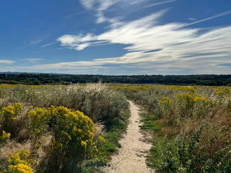
Habitat mapping
In particular, the mapped baseline should reflect the habitat present at the relevant survey stage. It should also provide a clear spatial record for later metric work.
For UKHab-based surveys, record the classification version, primary habitat and relevant secondary codes. UKHab currently recommends Consultation v2.1 alongside v2.0. Then map the field classification to the correct statutory metric habitat category.
Habitat condition evidence
Ecologists assess condition differently for different habitats. Where the Statutory Biodiversity Metric requires a condition assessment, use the relevant official condition criteria.
For deeper guidance on this specialist stage, see BNG Condition Assessment.
Coordinate the wider ecology survey programme
Agree a coordinated programme so each survey answers the relevant planning question and shared site visits collect compatible evidence.
For example, a Preliminary Ecological Appraisal, protected-species survey, arboricultural assessment or specialist watercourse survey may answer different planning questions. The required survey package should be proportionate to the site and proposals.
When should a BNG survey be carried out?
Government planning guidance says surveys used to calculate the pre-development biodiversity value should ideally be undertaken shortly before the planning application is submitted. This helps ensure the baseline reflects the habitat present at the relevant date.
Older survey information can still be usable. However, there must have been no material change to the onsite habitat when the application is submitted.
If the habitat has materially changed, do not use the earlier survey as the basis for the current pre-development value.
1. Survey early enough to inform design
For example, early field information can show which habitats to retain and where impacts may arise. It can also identify the need for specialist survey work.
2. Keep the application baseline current
If the application date will be the relevant baseline date, keep the habitat evidence representative of the site at submission.
3. Recheck after material site changes
Changes in land management, clearance, construction activity, access or habitat condition can affect whether earlier data remain suitable.
Tell the ecologist if the site has changed since previous fieldwork. They can then advise whether part or all of the site needs to be resurveyed.
Survey season and ecological competence
Survey timing depends on the habitat. In particular, the time of year can affect the identification of plants, grassland communities and the reliability of some habitat-condition observations. Therefore, scope fieldwork around the habitats present, access and suitable survey conditions. Where evidence is inconclusive, an appropriately timed follow-up visit may be needed.
For the full Statutory Biodiversity Metric route, use surveyors competent in the relevant habitat classification and condition methods. Government guidance recommends a competent person, such as an ecologist, for metric work outside the eligible Small Sites Metric exception. The skills needed for a specialist River Condition Assessment are different.
Earlier baseline dates and habitat degradation
The BNG framework contains specific rules where habitat has been degraded before the application or where an earlier date is proposed. These cases require careful evidence and cannot be resolved simply by choosing an old survey date.
If this applies to your site, the baseline date and evidence should be reviewed before the metric is finalised.
Plan the visit around the evidence you need
Use habitat-specific survey guidance and local conditions to choose the visit. This planning guide shows the questions to resolve when booking fieldwork.
| Feature | Evidence to capture | Programme decision |
|---|---|---|
| Grassland and other species-rich vegetation | Plant identification, abundance, community composition and the relevant condition observations. | Allow a suitable growing-season visit. Recent cutting, grazing or dry conditions may justify a further visit. |
| Woodland, scrub and hedgerows | Habitat structure, species, gaps, ground flora and criterion-specific features. | Combine structural observations with appropriately timed botanical evidence where needed. |
| Ponds, wetlands and watercourses | Habitat extent, vegetation, water conditions and the correct waterbody assessment method. | Agree safe access and specialist requirements early. Flooding, drought or vegetation visibility can affect coverage. |
| Previously surveyed land | Previous survey quality, boundary coverage and changes in habitats or management. | Ask an ecologist to assess reuse and update needs. CIEEM advises against one universal expiry period. |
How ACP carries out a BNG baseline survey
The exact method depends on the site. However, our survey process follows a clear evidence trail from initial scoping to checked baseline information.
01 — Review the site information
We review the location, red-line boundary, available plans, existing ecology information and planning stage. We also identify access constraints and specialist features.
Survey-stage output: agreed scope and information requirements.
02 — Complete the habitat field survey
The ecologist records the habitats present, their extent and the evidence needed for the agreed baseline methodology. They also record condition information where relevant.
Survey-stage output: field notes, habitat evidence and observations.
03 — Prepare baseline habitat mapping
Next, we transfer the field evidence into a clear map of habitat parcels and relevant linear features. The plan should reconcile with the surveyed boundary.
Survey-stage output: mapped pre-development habitat baseline.
04 — Review the survey evidence
Then, we check the mapping, measurements and relevant condition evidence for consistency. We also identify remaining data gaps, access limitations and specialist assessment needs.
Survey-stage output: checked baseline evidence and limitations.
05 — Hand the evidence to the agreed next stage
Finally, pass the checked baseline to the metric assessor and design team. Confirm the agreed next-stage services and any outstanding evidence before issue.
Survey-stage output: habitat information ready for the agreed downstream work.
A FIELD RECORD YOU CAN FOLLOW
From field observation to a checked habitat parcel
A useful survey record connects each observation to a mapped feature. This original teaching example follows parcel G01 through the checks needed before metric entry.
ILLUSTRATIVE GRASSLAND PARCEL
One parcel. A traceable evidence trail.
Boundary and extent
Record a 0.240 ha polygon, drawing reference BL-01 and its revision. Check the polygon against the site boundary and neighbouring parcels.
Habitat and species
Record the classification version, primary habitat and relevant secondary codes. Keep the species list, abundance observations and management notes supporting that choice.
Criterion-level evidence
Link the applicable condition sheet to G01. Record each criterion result and its supporting measurement or observation, with photographs G01-01 to G01-06.
Limits and follow-up
If recent mowing obscures identification, flag the uncertainty and arrange a suitable revisit. Record the survey date, surveyor, access coverage and reviewer.
The area and record references above are assumed for illustration. Apply the relevant official habitat criteria to the actual field evidence.
Continue with our habitat condition assessment guide or complete BNG assessment service.
Need the BNG survey scope confirmed before you book fieldwork?
Send ACP the site location, red-line boundary and any current plans or ecology information you already have.
We can review the available information and identify the likely baseline survey requirements. We can also flag specialist habitat or watercourse assessment that should be considered in the scope.
When is specialist survey work needed?
The baseline habitat survey can identify features that need a more specialist assessment method. Therefore, the correct route depends on the habitat or watercourse type and how it relates to the development.
Rivers, streams and canals
Relevant rivers, streams and canals may require a specialist River Condition Assessment for the watercourse element of the Statutory Biodiversity Metric.
Use an appropriately trained and registered RCA surveyor. Where proposals alter flows, banks, crossings or flood storage, coordinate the ecologist with the relevant hydrologist, geomorphologist, drainage or civil engineer. Each specialist supplies evidence within their competence.
Ditches
In contrast, ditches use a different condition-assessment route from rivers, streams and canals.
Where a ditch enters the BNG assessment, use the appropriate metric condition methodology rather than treating it as an RCA.
Other ecology surveys
BNG focuses on habitat value. Other ecological surveys may still be needed where protected species, designated sites or wider ecological constraints are relevant to the planning application.
Those surveys should be scoped for their own purpose rather than treated as automatic parts of the BNG habitat survey.
Key point: A good survey scope identifies these interfaces early, so the baseline evidence is complete without duplicating specialist work.
What you receive from the BNG survey stage
Therefore, the precise deliverables depend on the agreed scope. A BNG baseline-survey commission can include the field and mapping evidence needed to support the next stage of the project.
Habitat survey record
Documented habitats and relevant field observations from the visit.
Baseline habitat mapping
Mapped parcels and relevant linear features within the surveyed area.
Condition evidence where applicable
Field records for the relevant statutory metric criteria.
Survey limitations and specialist flags
Access constraints, data gaps and features requiring other work.
Agree the onward services in your quotation
Confirm whether the commission also includes the metric calculation, design testing, BNG report, Biodiversity Gain Plan or HMMP. Identify specialist watercourse and protected-species work at the same stage.
These can be commissioned separately or as part of a wider BNG assessment where appropriate.
What information does ACP need to scope a BNG survey?
You do not need every planning document before making an enquiry. However, the following information helps us understand the likely survey extent and any specialist requirements.
Where available, send:
site address or location;
current red-line boundary;
latest site or development layout;
approximate site area;
planning reference or current planning stage;
existing ecology or habitat reports;
known hedgerows, ponds, ditches, streams, rivers or canals;
known access restrictions or third-party land;
details of recent clearance, mowing, grazing, earthworks or other habitat-management changes; and
the intended application date, where known.
Start with the boundary if that is all you have
For example, a red-line plan and brief description of the development are often enough for an initial scope review.
If information is missing, ACP can identify the gaps that need to be resolved before the baseline evidence is finalised.
PLAN YOUR NEXT STEP
Build your survey enquiry brief
Choose what you know about the project. Get practical points to discuss with an ecologist and a brief you can copy into your enquiry.
Suggested points to discuss
Use this scoping aid to prepare a discussion with an ecologist. Your selections stay on this page; copy the brief into your enquiry when ready.
BNG survey cost and programme
How much does a BNG survey cost?
The survey fee depends on the site and the agreed scope rather than one universal rate.
Factors can include:
site area and the number of habitat parcels;
habitat diversity and condition-assessment requirements;
hedgerows and watercourses;
safe and lawful site access;
the amount and quality of existing habitat information;
whether specialist assessments are needed; and
whether ACP is providing survey-only evidence or a wider BNG assessment service.
Therefore, ACP will provide a project-specific quotation after reviewing the available site information.
How long does a BNG survey take?
The programme depends on survey availability, site access, site complexity, seasonal or habitat-specific constraints and the downstream deliverables included in the commission.
Therefore, the quotation should confirm the proposed fieldwork and delivery programme for the individual project.
If a planning deadline is fixed, provide the intended submission date at enquiry stage. We can then review the scope against the available programme.
Frequently asked questions
What is a BNG survey?
A BNG survey records the habitats, mapped extent and condition evidence needed to establish the pre-development biodiversity baseline. That evidence can then support the Statutory Biodiversity Metric and wider BNG assessment.
Is a BNG survey itself a legal planning requirement?
The law does not prescribe a document called a “BNG survey” for every application. Where mandatory BNG applies, specified application-stage information is required, and an appropriate habitat survey is usually needed to establish reliable baseline evidence.
What BNG information must be submitted with the planning application?
The national minimum includes the pre-development biodiversity value, completed metric calculation and baseline-date information. It also covers relevant degradation evidence, any irreplaceable habitat and scaled onsite habitat plans. Additional information may be requested where material to the application.
Do I need to submit the Biodiversity Gain Plan with the planning application?
Not as part of the national minimum application-stage information. For the Town and Country Planning Act route, submit the statutory Biodiversity Gain Plan after permission. The planning authority must approve it before development begins. A draft may be shared earlier.
When should the BNG habitat survey be carried out?
Survey evidence should ideally be current close to application submission. Older information may remain usable where there has been no material habitat change. Otherwise, updated survey evidence may be needed.
Does the BNG survey include the Statutory Biodiversity Metric calculation?
Not automatically. The survey collects habitat evidence; the metric calculation is a separate technical stage. ACP can provide both where they are included in the agreed scope.
Can a small development use the Small Sites Metric?
Potentially, where the development is not exempt and meets the current Small Sites Metric eligibility criteria. Check the exemption position before selecting the metric route.
What happens if the site contains a river, stream, canal or ditch?
Record the feature and confirm the correct assessment route. Relevant rivers, streams and canals can require River Condition Assessment, while ditches use a different metric condition-assessment approach.
Is a BNG survey the same as a Preliminary Ecological Appraisal?
No. A BNG survey focuses on habitat evidence for biodiversity-value assessment. A Preliminary Ecological Appraisal has a broader ecology purpose and can consider other ecological constraints and further survey needs.
How much does a BNG survey cost and how long will it take?
The fee and programme depend on the site, access, habitat complexity, specialist requirements and agreed deliverables. Send ACP the boundary and available plans for a project-specific scope, quotation and programme.
Official BNG guidance and useful sources
Technical review: 1 November 2026. Government guidance defines the statutory requirements. UKHab and CIEEM provide the classification, competence and survey-quality context.
GOV.UK — Biodiversity net gain planning practice guidance
Explains the minimum BNG information required with relevant planning applications, the pre-development value and relevant date, and the later Biodiversity Gain Plan process.
GOV.UK — Statutory Biodiversity Metric tools and guides
Provides the current statutory metric calculation tools, user guides and habitat condition-assessment resources.
GOV.UK — Calculate biodiversity value with the statutory biodiversity metric
Explains use of the statutory metric, the main calculation route and the relationship between habitat information and biodiversity values.
GOV.UK — Biodiversity net gain: exempt developments
Sets out the current exemptions, including the changes that took effect on 6 August 2026.
GOV.UK — Biodiversity Gain Plan
Provides the current Biodiversity Gain Plan templates and confirms that the statutory plan can be submitted after the planning application has been approved.
GOV.UK — BNG for nationally significant infrastructure projects
Provides the current separate BNG guidance for nationally significant infrastructure projects, including the applicable regime, application requirements and Biodiversity Gain Plan process.
UKHab — classification for BNG surveys
Current classification versions, secondary codes, survey competence and the separate river-condition route.
CIEEM — lifespan of reports and surveys
Assessing whether existing ecological evidence remains suitable for a planning decision.
CIEEM — habitat survey competency standard
Competence and professional judgement for habitat survey, mitigation and management.